Technology
Archived — This article has been archived. The information may be outdated.
NISAR radar maps Antarctic ice pattern
NDTV··25 Jul
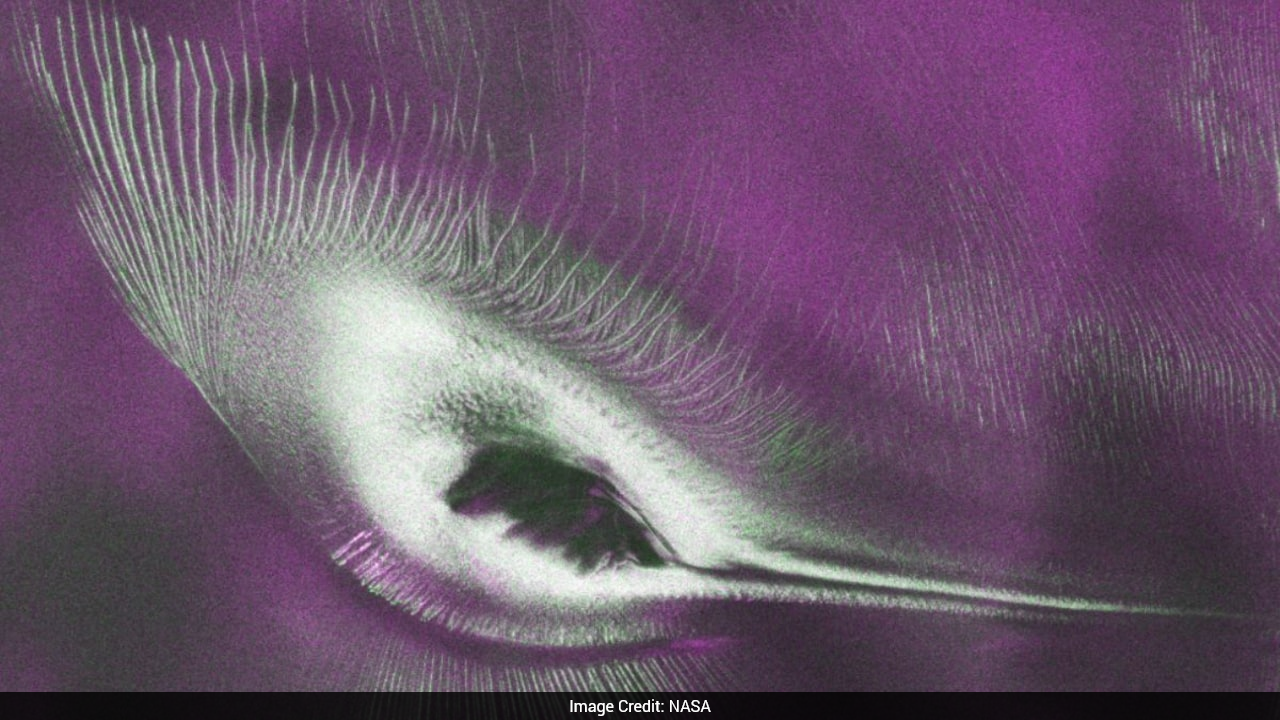
NASA-ISRO NISAR mission L-band radar captured a hummingbird-like pattern beneath ice at Nunatak Zaterjavshijsja in East Antarctica. Public data access began from July 20. Radar sees through ice unlike optical imagery, revealing subsurface features hidden from conventional satellites. The release marks an early science win for the joint mission. NISAR L-band radar captured a hummingbird-like pattern in East Antarctica.
Prism
What It Means For You
- NISAR L-band radar revealed a hummingbird-like pattern at Nunatak Zaterjavshijsja in East Antarctica.
- Public data access began July 20 for the joint NASA-ISRO Earth observation mission.
- Radar penetrates ice unlike optical imagery, opening new climate monitoring possibilities.
What's Happening
- NASA-ISRO NISAR mission released its first public L-band radar image on July 20.
- The capture shows a hummingbird-shaped pattern beneath Antarctic ice at Nunatak Zaterjavshijsja.
- Radar sensing sees through ice sheets where optical satellites cannot observe surface detail.
NASA ISRO Radar Sees Through Ice
- NISAR combines NASA and ISRO expertise in a flagship bilateral space partnership.
- Antarctic ice mapping supports sea-level and climate change research globally.
- Public data release enables scientists worldwide to analyze polar subsurface features.
all-newstop-stories